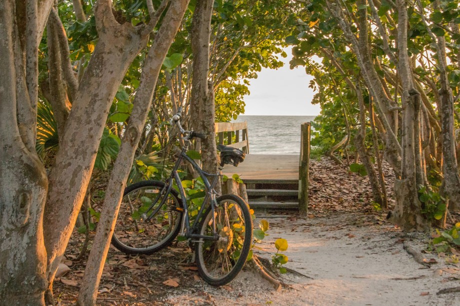
When planning a day at the beach, it is wise to check the tide schedule. Knowing the surf forecast can make or break your day at the beach!
Sanibel Island Tide Chart
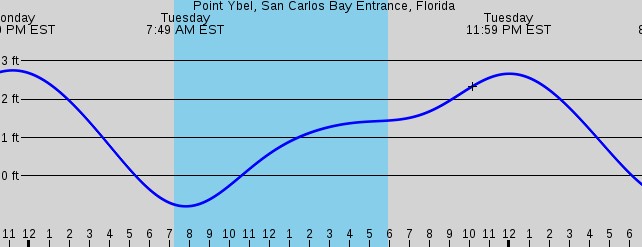
Tide times are published online for all coastal areas. This helps fisherman, boaters, and wildlife enthusiasts know exactly when high tide or low tide will be. You can find many tide charts online. The National Oceanic and Atmospheric Association (NOAA) has a great website that shows tidal changes in local time including lowest tide, highest tide, and tidal height for locations all over the world, including Sanibel Island. The Point Ybel area (Sanibel Lighthouse) at the San Carlos Bay Entrance are the tide points for which tide data is provided.
Paper copies of Sanibel Tide Charts can also be found at some local boat rental facilities, tourist information centers, and some hotel lobbies. Whether on paper or digital, referencing a tidal table before your adventure will help you determine when the next high tide and low tide will be.
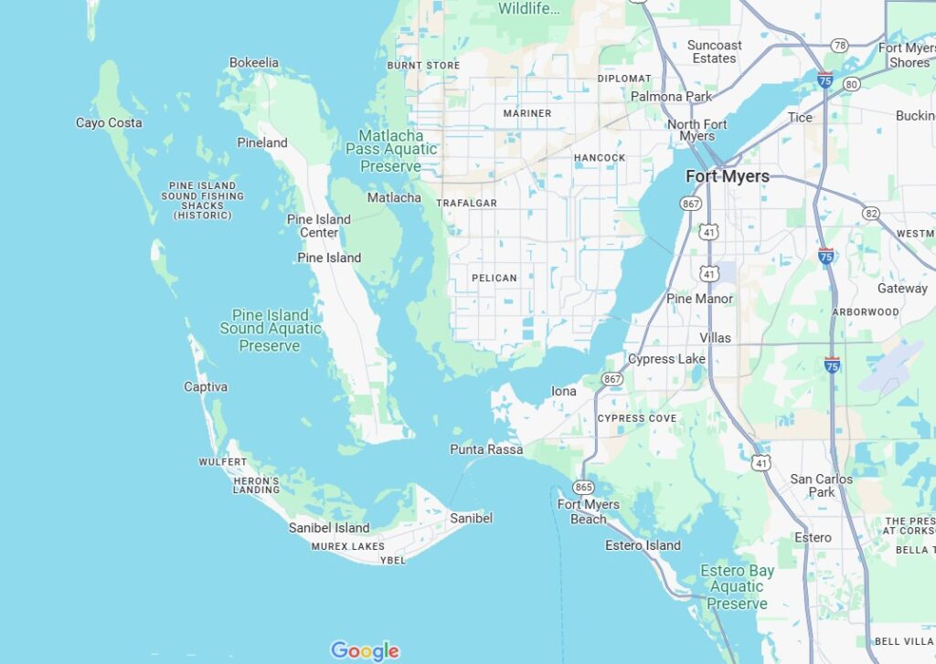
Where is Sanibel Island?
Sanibel Island, Pine Island, Captiva Island, North Captiva Island, Estero Island, Picnic Island and Black Skimmer Islands are all part of the Sanibel Archipelago of the Gulf Coast. These barrier islands sit just off the west coast of Fort Myers and St. James City. They are about 2.5 hours south of St. Petersburg and Tampa Bay.
Having an ideal water temperature for year-round swimming, shelling opportunities, boating activities, wildlife viewing, and fishing, Sanibel Island is a great place to visit any time of year.
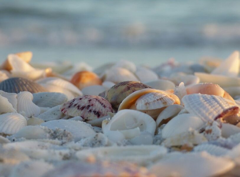
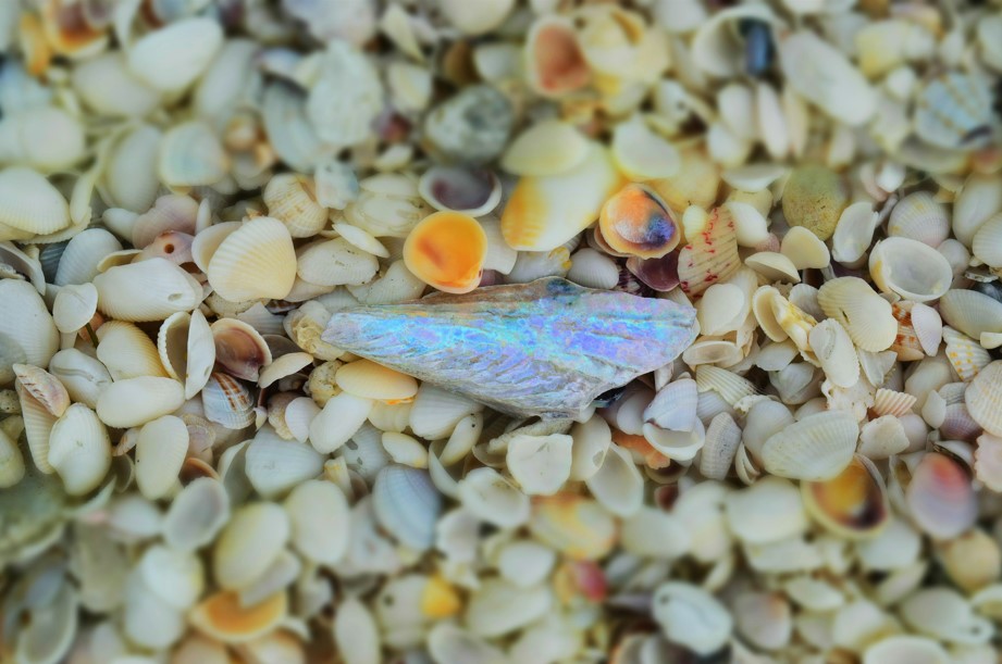
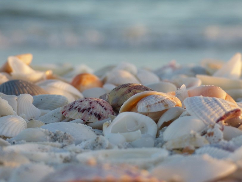
Shelling on Sanibel Island
Most barrier islands are orientated north to south. The orientation of the coastline of Sanibel Island is quite unique. Its “east-west” orientation contributes to its excellent sand beaches and shelling opportunities. People come from all over to find incredible shells on the beaches of Sanibel Island. Want to be a serious sheller or at least have a good day collecting your treasures? Master these tips:
The best times of day to find shells on Sanibel Island
- Early morning low tide, especially 1½ hours before and after low tide
- During low spring tides – specifically a lunar spring tide.
- After storms, when waves have stirred up and deposited shells
The Best Seasons for shelling on Sanibel Island
- Winter months (January through April) are considered prime shelling season
- Hurricane season and summer months can also offer good shelling opportunities after tropical storms
Peak Periods for Shelling at Sanibel
Since Sanibel Island is a hot spot for shelling, our recommendation is to plan a trip around a lunar neap tide. Lunar neap tides produce the lowest low tides, which are ideal for shelling as they expose more of the beach and reveal shells that are normally underwater.
Important Reminder
Live shelling is prohibited on Sanibel Island. This means you cannot collect live shells, sand dollars, starfish, or sea urchins.
How do tides impact the Sanibel Island area?
San Carlos Bay, located southwest of Fort Myers contains a 718 acre Bunche Beach Preserve. It connects to Pine Island Sound to the west and Matlacha Pass to the north. Popular with wildlife enthusiasts, paddlers and fishermen, this area features tidal wetlands with beach, mangrove forests, and salt water “flats”. This area is excellent for birdwatching, swimming, fishing, photography and wildlife viewing. Low tide have periods of greatest activity for wildlife, so be sure to reference official tide tables of the port of Sanibel when planning your day.
Birding
Tidal changes affect wildlife activity, particularly for wading birds and marine life. Low tides can reveal tidal pools and flats, increasing the available sources of food for various species of birds. Watch for unique birds to visit tide pools left during the lowest tides of the day.
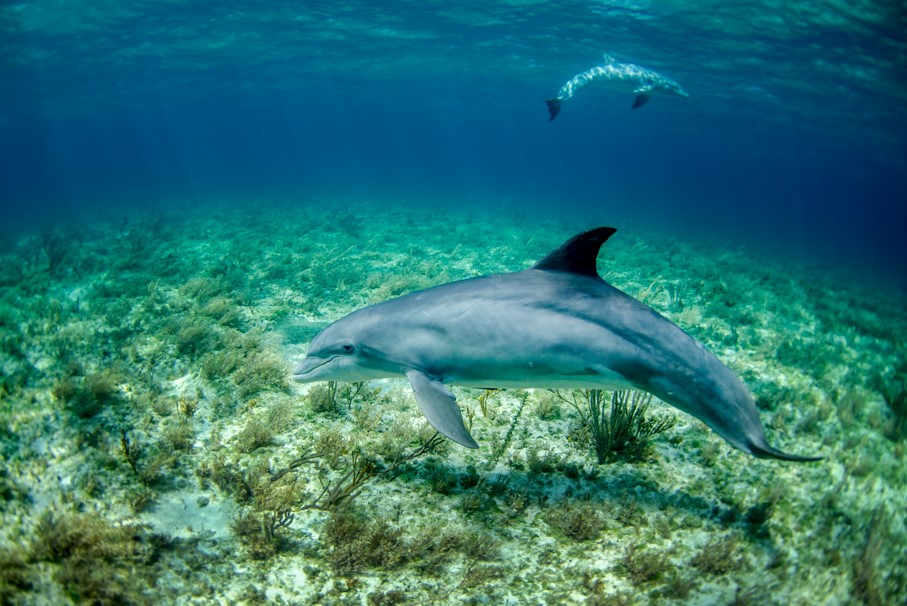
Wildlife Tours
Low tide is generally better for watching dolphins and manatees in Tarpon Bay. During low tides it’s easier to spot manatees and dolphins in the shallower waters, who may be taking advantage of mud and grass floats that create feeding opportunities.
Beach Exploration
Low tides can reveal sandbars and expand beach areas for exploration.
Fishing
Tide changes influence the behavior of fish and accessibility of fishing spots. Anglers use tide information to plan their trips for the best catch potential.
Boating
Understanding tide patterns is crucial for avoiding getting stranded or caught in strong currents, particularly in areas like Blind Pass, Redfish pass, and Matanzas Pass.
By consulting tide schedules, travelers can maximize their experience and safety while exploring San Carlos Bay and its surrounding areas.
Are you a Road Scholar?
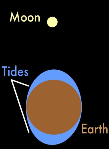
If you’re a road scholar like us, you may need a refresher about what causes high tide and low tide. Surprisingly, the moon plays the most important role! The moon’s gravitational force tugs on all parts of the Earth, including ocean water. As the Earth spins, different parts of the ocean get pulled by the moon, which is why some beaches have high water at certain times and low water at other times.
Since the passage of the moon moves in a predictable pattern, tide charts can be calculated well into the future.
Additionally, tidal variations are a result of the specific position of the moon. Full and new moons result in higher high tides and lower low tides since the sun and moons gravitational pull work in tandem. These tides are called Neap tides.
Tide tables reference tidal coefficients which tell us the amplitude of the tide forecast (difference in height between the consecutive high tides and low tides in any given area). Knowing the progression of the tidal coefficient today are important to fishermen to make a determination of suitability for fishing. We know that large coefficients can produce optimal seabed of the beaches for fishing in some places, but perhaps elsewhere they may drag too much algae and dirt, making fishing impractical.

Grab a Sanibel Tide Chart!
Whether you’re spending your time on Sanibel Island for wildlife viewing, fishing or shelling, referencing a Sanibel Island Tide Chart is sure to make “waves” in your planning!